Hiking is such an interesting activity that gets you revved up all day along with the experiences it comes with. One of such things you want to do is to be fully geared up for your next adventure on the mountain trails -nothing standing in between you and your chance of getting your dream hiking.
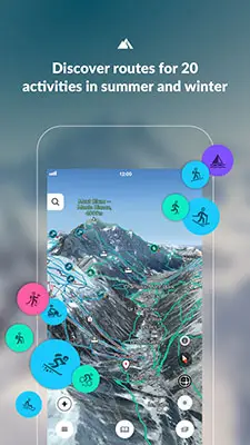
Hiking is like getting the taste of the nature out there and more often than not, it comes with a lot of therapeutic benefits you almost wouldn’t be able to get anywhere else. But to get the best of the outdoors, stepping out with recommended apps for hiking can make all the difference and help take your hiking experience to a whole new level.
| Name | Features | Price | In-App Purchases |
|---|---|---|---|
| AllTrails | Over 50,000 Routes in Canada and US | Free | Yes |
| ViewRanger | Allows For Map Download For Offline Use | Free | Yes |
| Komoot | Voice Navigation Feature | Free | Yes |
| Bergfex | Topographical Maps For Europe | Free | Yes |
| Fatmap | Low Battery Consumption Rate | Free | Yes |
| Hiking Project | 3D View | Free | No |
| REI | GPS Tracker | Free | No |
From hike logs to trail information and social networks for mountain hikers, we have prepared the guide of best hiking apps that is certain to bring these essentials to your fingertips.
So, if you are stepping out to the wild and ditching your comfort zones behind, be sure to have your phone(s) fully charged and have these apps handy on your mobile phone, be it iOS or Android.
1. AllTrails
Android iOS
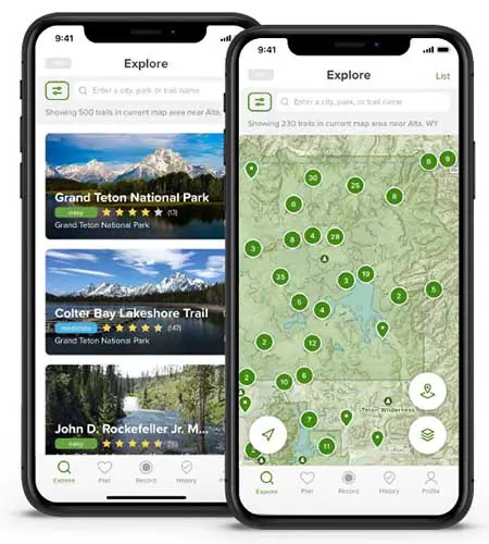
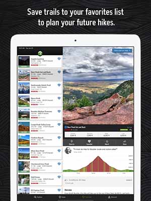
If you are stuck with the feeling that you have been roaming on the same trail over and over, you know, like in a rut, the AllTrails is the app to save the day. It comes with a good interface and it is incredibly user-friendly. With its over 50,000 routes in the United States and Canada, your hiking experience has never been made better. It has been collectively organized by mountain hikers and bikers all around the country and you can feel at ease when recording or uploading your routes for sharing purposes. With the AllTrails, you can easily narrow down trails that are dog-accessible, kid-friendly, and allows for wheelchair without breaking a sweat. The app is great at keeping a record of your activities and a detailed information of how much you have hiked per month.
With the app, you can make your own trails with the app’s GPS tracking feature, create photos, texts and share others or keep them stored on the app. It comes with an option to upgrade to the PRO version wit $30 yearly membership and allows you to enjoy a partnership with the National Geographic Maps hence enabling you the opportunity to edit and print maps.
The AllTrails also come with events including World Elevation Challenge which allows you as a participant to keep track of your hiking progress on Matterhorn, Everest and the likes just as you compete with others.
 |
Pros
Cons
|
2. ViewRanger
Android iOS
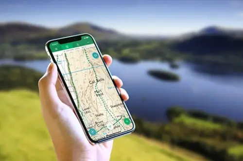
Another free and versatile app to take with you for hiking is the ViewRanger. It is an incredible GPS trail finder app that comes with both free and premium feature contents to help you make the most of your time on the trails. One of the advantages of the ViewRanger over many other hiking apps out there is that it is able to use map offline. Impliedly, you can easily download maps and trails for free and for offline use. However, you will need to upgrade to premium to access paid maps like USGS Topo and USA.
With the ViewRanger comes an incredible feature-Skyline AR viewer. This featured augmented reality function allows hills, peaks and other interesting points to be easily flagged on your camera view. It also comes with over 180,000 trails and allows for printing of maps. With the ViewRanger, you can also import files like GPX, plot points that interests you, track routes, and as well read some other useful navigation stats.
 |
Pros
Cons
|
3. Komoot
Android iOS
When it comes to interface, design and graphics quality, the Komoot is a top player. Coupled with its ability to provide you great visuals is the face that it is very easy to use. It comes with many features which makes it the go-to hiking app for many hikers out there.
One of its many features is the voice navigation function. As soon as you close in on a route you like, you can store or save it to your profile and from there, editing or doing multiple save-as to have many versions comes relatively seamless. Thus, all the routes you store in your profile pops up on the Komoot app and with the voice navigation, you can connect your phone to a headset or turn up the volume while it’s tucked away in your pocket.
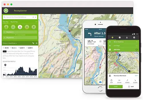
The komoot also allows for route syncing to Wahoo, Garmin, Lezyne, as well as Sigma Rox so as to enjoy on-screen prompts all day long. It also helps to determine the best route to wherever you are going, by simply tapping on any point on the map, the app immediately calculates the best route to get to that point. More importantly, it allows you to connect easily with other hiking enthusiasts around the world just as it ensures your activities are tracked and recorded appropriately.
 |
Pros
Cons
|
4. Bergfex
Android iOS
Whether you are up for a long hike or a short mountaineering, the Bergfex app is one of the best digital companions out there and you will glad to take it up there with you. Because it is very versatile and comes with many features, it is loved by many hikers.
It features well informative topographical maps for Europe, anywhere you are around the European regions, you have got the trails handled with the Bergfex app. More so, it comes with over 70,000 GPS routes which makes the app trail-ready and up for any adventure onto the mountains. One of the features that puts it at the forefront is its superior search functionality. It has a very great search power and you can easily pull up information without difficulty.
The details of your hikes and all of your other activities on the map are automatically synced to your Bergfex account, but that’s optional. That means you will have all of your hike data backed up and available on all your devices. More interesting about the app is the offline map usage functionality. Thus, when you upgrade to the pro version of Bergfex, you can use your maps offline without having to on your internet or mobile connection before you can navigate with the app. With the app, you can also make a plan of your tour from a starting location to anywhere on the mountain, thanks to the many waypoints it comes with in the PRO version.
The iOS Bergfex app is compatible with the AppleWatch and will show statistics, maps, pulse and lots more for a hassle-free usage in the outdoor.
 |
Pros
Cons
|
5. Fatmap
Android iOS
With the Fatmap hiking app, you can never go wrong on the trails. If you are still indifferent about the dependability and quality of many hiking apps out there, the Fatmapp is certainly going to leave you with no doubts. The maker’s mission being that they want to get 3D maps to as many as possible users out there; yes, 3D maps. So, if you want to get more out of your hiking experience, get yourself the Fatmap.
Having tested the app, the usability is topnotch and incredibly smooth. The maps come clean and are well rendered for seamless zooming and dragging. The Fatmap implement an ultra high-res 3-Dimensional landscaping system which provides real-time terrain imagery on 1 to 1 ratio scale for improved sense of location and space. You get to enjoy 3D topographic maps from USGS, basemap.it, IGN, swisstopo and many more.
The app features map download for offline use. Maps save directly to your phone and loads up anytime you are set to use without need for internet connection. Because it is meant for the outdoors, it has been factored into the design of the app to last long and optimize phone’s battery. So, you need neither fret nor cloud your experience with worry over your battery getting used up.
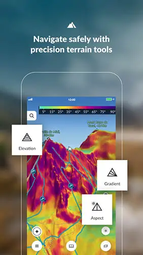
With the paid PRO version of the app, you have more access to information about whichever mountain you are looking to hike. You are also able to see the best spots to take-off lifts, pistes/runs and can view gradients, risk zones, avalanches, and spots you should stay away from on that mountain.
 |
Pros
Cons
|
6. Hiking Project
Android iOS
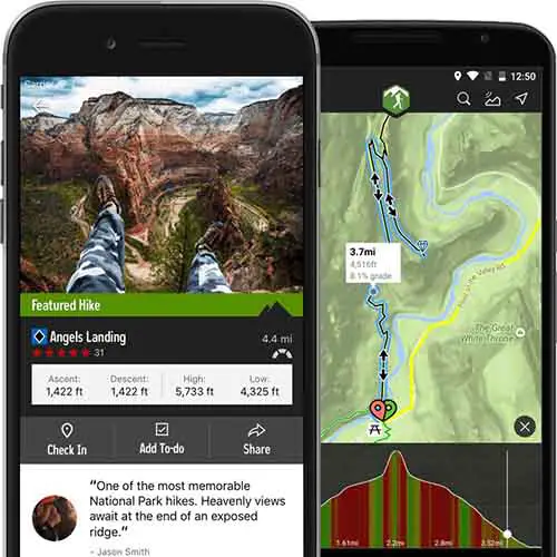
If you are keen on getting the best hike you will be grateful to yourself for, you should be up the trails with the Hiking Project. It is a special app by REI made exclusively for hiking enthusiasts like you and for all that cherish the beauty that lies around the mountain and beyond.
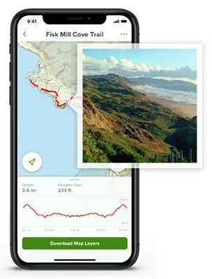
It provides comprehensive and exquisite guide to the best trails near you, no matter your location. It features a GPS route info and comes with a fantastic elevation map. This map is designed to sync with the 3-Dimensional view such that your location on the map changes just as you move along your hike. It thus gives you information on the changes in the trail elevation and the distance you have covered and need to cover.
On this app, you have access to more than 74,000 miles of hike trails even as new trails are being uploaded to the app for a robust hiking database. The search feature of the Hiking Project allows you to search for a route by checking through the map or simply searching by name. The maps are downloadable by state and thus you can maximize the memory for only the spots you are particular about.
The Hiking Project reveals your exact location on the trail and allows you to download trails for use when offline irrespective of the type of phone you use. It automatically syncs your activities with your check-ins as well as your to-do list with your hikingproject profile.
 |
Pros
Cons
|
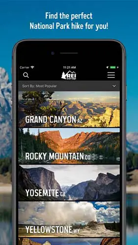
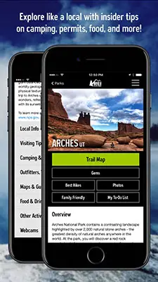
7. REI
Android iOS
REI is the shortened form of Recreational Equipment Inc. and is a one of a kind hiking app made by REI’s National Park. It is the choice of many hikers largely because of the free guide it comes with which covers the national parks in the country including trails guides and maps, as well as GPS navigation system. The GPS tracker it comes with work in real-time and features elevation profile details on a satellite map or terrain. It also features a list of selected hikes included with captions and ratings as per difficulty. Whether you are stuck or faced with an emergency, you can easily send your detail coordinates to nearby rescuers without breaking a hassle.
If you are looking to step out on the trails with your family or a group of friends, you will find this app to be a blessing. This is because the REI app suggests different attractive locations you can come across on each trail which are very family-friendly.
The REI app is very informative on details like camping point specifics, visitor center hours, details of activities and lots more for respective park entries. You can simply search for hikes present in the park with the map display. Should you desire to get a map printed, the app connects you to nps.gov where you can make a pick from their selection.
 |
Pros
Cons
|
Conclusion
While the list of hiking apps out there are endless, the best ones separate themselves from the pack with distinguishing features. Whether you are up for a short hike or preparing to step on the trails with your loved ones, these apps are certain to help you get the best of your hiking. Now that you are here, all you need is to make a choice and see your hiking experience take a whole new turn for the best!
You may also like:


One comment
Comments are closed.